2017 Crashes Oxford
$20.00
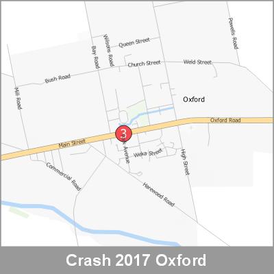
2017 NZTA CAS Data showing Crashes in Oxford
Description
2017 NZTA Crash Analysis System (CAS) showing the location of vehicle crashes visualised as point cluster data based on crash location proximity.
Downloads
![]() A4 Oxford Print Map (pdf)
A4 Oxford Print Map (pdf)
![]() A4 Oxford Image (jpg)
A4 Oxford Image (jpg)
![]() Map Legend (jpg)
Map Legend (jpg)
Map Scale
1:15000